What you get
A desk study, done in minutes.
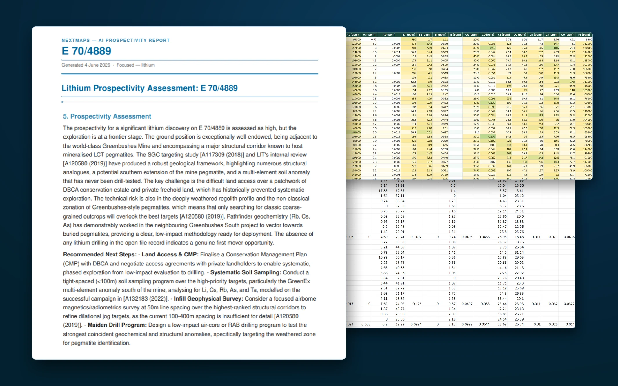
A Prospectivity Data Room for any ground
For a tenement or a drawn area, NextMaps reads the historical WAMEX archive into a referenced prospectivity assessment: geological setting, mineralisation controls, past programs, the grades and anomalies, and clear next-step drill targets, every claim cited back to its A-number. You get three things: the prospectivity report (PDF and Markdown), a compiled Exploration Data Room, and the WAMEX source archive it was all built from.
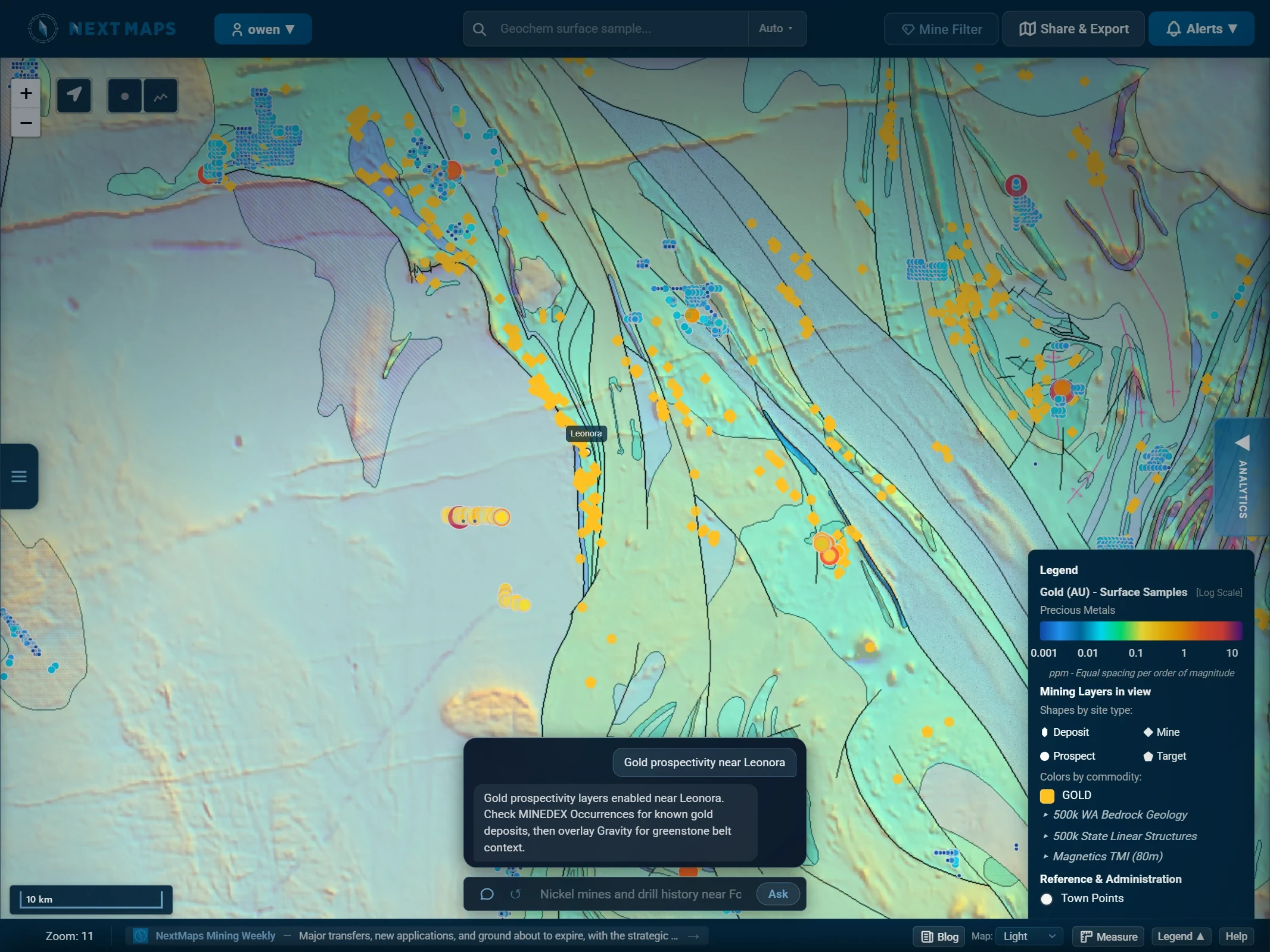
The Map Explorer agent
Type a goal in plain English and the map builds itself, layers, filters and all. Ask for "gold prospectivity near Leonora" and the right tenure, geoscience and intelligence layers switch on for you.
Gold prospectivity near Leonora
Ask