
TENGRAPH
TENGRAPH Web is the Western Australian government's mining tenement map, run by the Department of Mines, Petroleum and Exploration. It is the authoritative record of who holds what, it is free, and if you are pegging ground you should be checking it. You will also see it called TENGRAPH Online, DMIRS TENGRAPH, the WA tenement map or the WA mining lease map, and misspelt Tenegraph about as often as not.
Looking for TENGRAPH itself? It is run by the Department of Mines, Petroleum and Exploration, it is free to view, and it asks for a quick registration. This page is not it.
First time? The department's access and getting-started page covers registration and its own training material.
What follows is what it shows, the overnight window that decides contested ground, and the jobs it leaves you to do somewhere else. Written by people who use it.
What TENGRAPH shows you
Open a tenement and you get the official boundary, the tenement number, the holder, grant and expiry dates, type, area, status and the basic conditions. For confirming the record, that is the whole job and it does it properly.
| Tenement type | Code | What it is |
|---|---|---|
| Prospecting licence | P | Small-scale ground, commonly used by prospectors and for holding a target while you look. |
| Exploration licence | E | The workhorse. Graticular blocks, expenditure conditions, and a term that steps down over time. |
| Mining lease | M | Ground held to mine, with the heaviest conditions and the longest life. |
| Miscellaneous licence | L | Infrastructure over other ground: roads, pipelines, power, water, haulage. |
| Retention licence | R | A known deposit held back from development while it is uneconomic. |
| Pending application | — | Lodged but not yet granted. This is the category that makes TENGRAPH worth checking. |
The overnight window
This is the part of WA tenure that costs people ground, and it is the reason the forums are right that you should check TENGRAPH before you peg.
The department's daily batch of surrenders and withdrawals is published in the late afternoon, around 4:30pm. An exploration licence application lodged after that and before 8:30am the next morning is treated as received at 8:30am.
So there is a window of roughly sixteen hours in which ground can be contested and every application inside it is equal. If more than one applicant lands in that window, the ground goes to ballot. Miss the window and you may be out entirely, not because you were slower, but because you found out the next day.
The information is public. Almost nobody is parsing a raw notices feed several times a day to catch it, which is the actual gap between knowing the rule and acting on it.
One distinction worth carrying into that window: a voluntary partial surrender is open for application immediately, while a compulsory surrender carries a release date and a moratorium before the ground is available. Which one you are looking at decides whether you move tonight or wait.
The one thing only TENGRAPH has
A newly lodged application exists inside the department's own system before its geometry is published anywhere else. External mapping platforms, this one included, read the departmental spatial downloads, and those do not carry a new application until the department processes it, which is a day or two later. So a brand-new application can already be sitting over ground you are looking at while every other map still shows it as open. For checking fresh applications, TENGRAPH is the only live source and nothing here changes that.
Where TENGRAPH leaves you
None of this is a criticism of the tool. TENGRAPH is a register viewer and it views the register well. These are simply the jobs it was never built to do, and the ones that eat the week if you are doing them by hand.
- It will not tell you anything
- A tenement can expire, surrender, transfer or change status and TENGRAPH stays silent. You either look every day or you find out late.
- Expenditure is a commitment, not a performance
- You can read the minimum expenditure condition. You cannot see what was actually spent, who is underspending, or which ground is drifting toward forfeiture.
- Holder research is one search at a time
- You can look a company up, but assembling its full WA footprint means repeating the search and rebuilding the picture yourself, and most ASX companies hold through several entities.
- Getting data out is a workflow, not a button
- Moving tenure into QGIS or a spreadsheet usually means bouncing between TENGRAPH, Mineral Titles Online and a manual export.
- It was not built for the field
- It works in a mobile browser. That is not the same as being usable on a bonnet in the Goldfields.
Ground coming free is the other direction
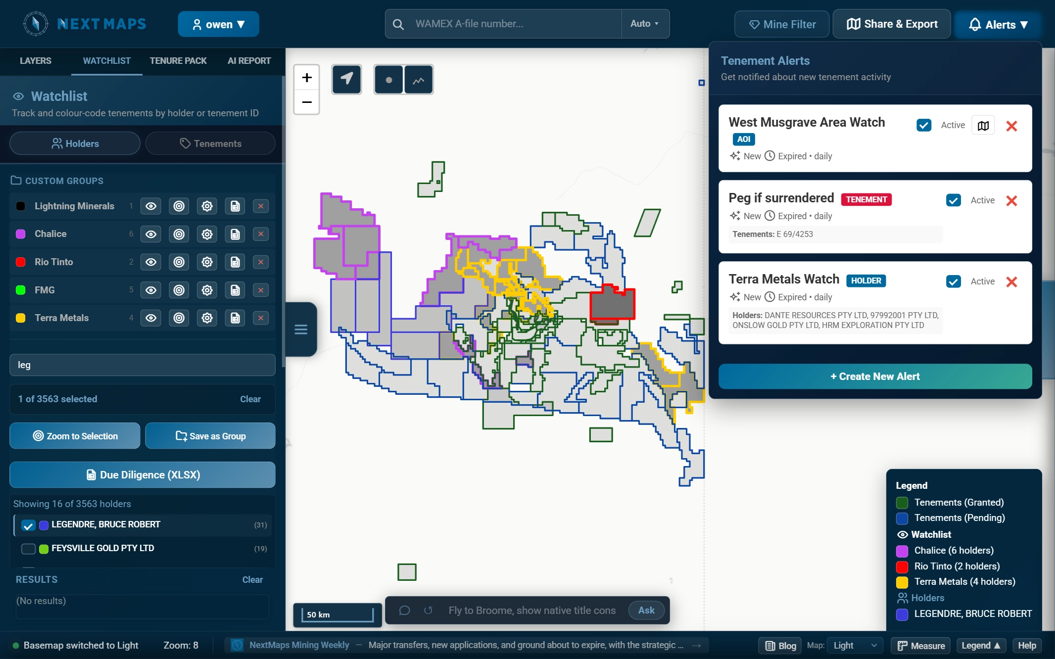
Where TENGRAPH is the only live view of applications, it is not the only live view of ground being given up. Surrenders, withdrawals, expiries and forfeitures are published to the department's public notification feeds as they happen. Anyone can read them. Almost nobody does, several times a day, which is why a partial surrender next door can sit unnoticed for a fortnight. We read that feed and put what it says on the map the same afternoon, and if it is inside an area you are watching, you get an email rather than having to go looking. How the alerts work.
TENGRAPH and NextMaps, side by side
We are not a replacement for TENGRAPH and this table is not trying to make that case. It is the authoritative record and the only live view of a freshly lodged application. The honest split is: verify in TENGRAPH, monitor everything after that somewhere built for it.
| TENGRAPH Web | NextMaps | |
|---|---|---|
| Authoritative tenure record | Yes, it is the source | Mirrors it, verify against TENGRAPH |
| Newly lodged applications | Immediate, with geometry | Same-day notice, boundary next day |
| Surrenders, withdrawals and forfeitures | Immediate, if you look | Same afternoon, and it tells you |
| Overnight and weekend monitoring | No | Yes |
| Alerts over an area, a holder or a tenement | No | Yes |
| Expenditure performance and compliance | Commitment only | Actual against minimum, scored |
| Holder portfolio in one view | Limited | Yes |
| Geology, geophysics and mineral mapping | No | Yes |
| WAMEX reports footprinted on the map | No | Yes |
| GIS-ready exports | Limited | Yes |
| Due-diligence packs and WAMEX desk studies | No | Yes |
Common questions
Is it spelled TENGRAPH or Tenegraph?
TENGRAPH is the official spelling. "Tenegraph" is a common misspelling on forums and in search, and it will still find the right thing.
Is TENGRAPH free?
Yes for viewing. It asks for a quick user registration, and there is no charge to look at tenure.
Is TENGRAPH live?
For newly lodged applications, yes, and it is the only live source: the geometry is not published to external feeds until the department processes it. For expiries, surrenders and status changes, the department publishes those to public notification feeds that anyone can monitor, so live is no longer exclusive there.
Is TENGRAPH the same as Mineral Titles Online?
No. TENGRAPH is the map. Mineral Titles Online is the transaction and administration system: lodging, expenditure reporting, compliance and documents. Most WA explorers use both, for different jobs.
Is there a TENGRAPH app?
No dedicated mobile app exists. It runs in a mobile browser, with the caveats that implies.
How do I check whether I can prospect on a piece of ground?
Check the tenure first, then the land access overlays, which are a separate question from tenure and often the one that actually stops you: pastoral leases, conservation reserves, Aboriginal heritage and native title all sit over the same ground.
Verify in TENGRAPH. Watch everything else here.
The live map layers every WA tenement over geology, geophysics, satellite mineral mapping and the WAMEX archive, with the register read daily for expenditure pressure and ground about to come free. Draw an area of interest and you will hear the morning something inside it moves. Browsing tenure needs no account.
Open the live map About the map Set up alertsTenure data sourced from the DMPE public registers and SLIP WA (© Government of Western Australia, CC BY 4.0), as at 2026-10-13. Compiled by NextMaps. Verify against primary sources before reliance.