
What's new in NextMaps since Premium and Pro launched
A roundup of what we have shipped since the Premium and Pro launch: AI prospectivity reports that stay on your ground, WAMEX intelligence that filters and extracts the drilling and geochem for you, tenement data that runs off our own fresh feed instead of the lagging public one, and a faster timeline.
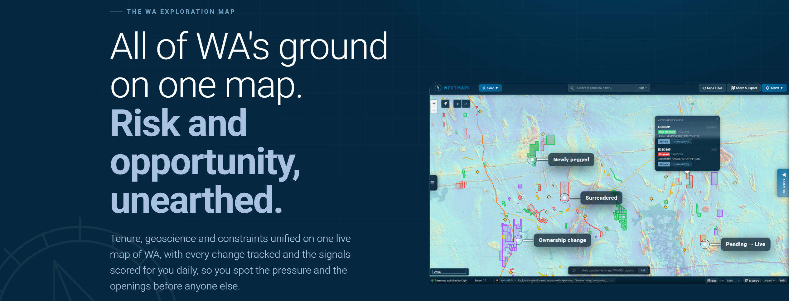
We launched Premium and Pro at the start of July, and we have not slowed down since. Here is a roundup of what has landed in NextMaps in the couple of weeks since, most of it aimed at one thing: turning the raw public record into something you can actually make a decision on, over your own ground.
AI prospectivity reports that stay on your ground
The Prospectivity Data Room reads the WAMEX history behind a tenement or an area you have drawn and writes up what it finds. The first version had a geologist's least favourite habit: it treated a regional program that clips the corner of your block the same as one centred on it, so a drill hole 30 kilometres away could end up quoted as if it were local evidence.
That is fixed. Reports now weigh every source by how much of its mapped footprint actually sits on your ground, and everything is tagged by distance:
- Overlap tiers: each WAMEX report is sorted into high, partial or marginal by the share of its footprint inside your area, and the write-up leans on the ones that are genuinely about your ground.
- Distance bands: drill results and samples carry how far they sit from your boundary, so district context reads as district context and cannot masquerade as an in-area result.
- Named places: nearby prospects and workings come with a distance and bearing from your ground, and anything beyond a couple of kilometres is called out as off-area.
The verdict now rests on in-area evidence, and the built-in verifier flags any claim that quietly relocates a result onto your tenement. The upshot is a report that reads like it is actually about your block, not a summary of the whole belt.
WAMEX intelligence, part one: filter to what you need
WAMEX is a goldmine and a haystack. There are tens of thousands of open-file reports, and most of the time you only want the ones that contain a particular kind of work. So the WAMEX layer now filters on what a report actually contains, not just its title:
- Drilling reported
- Geochem and sampling
- Geophysics
- Target commodity
- Contains a resource estimate
- Has a digital data package
- Final surrender reports only
- Hide the "no exploration conducted" reports
Tick what matters and the map shows you the reports worth opening, instead of leaving you to eyeball forty PDFs to find the three with drilling in them.

WAMEX intelligence, part two: pull the numbers out
Filtering finds the right reports. The Data Room now goes a step further and lifts the actual results out of them, so you are reading numbers instead of scrolling scans:
- Significant intercepts: where a report was lodged with GSWA digital drilling data, we composite the raw assays into industry-style intervals (grade by length, sensible internal dilution), scoped to your ground so a bonanza hole 15 kilometres away in a regional annual cannot pass as yours.
- Reported intercepts: plenty of good drilling only ever exists as a table inside the PDF. We harvest the operator-stated intercepts straight from the report text, with the page they came from, so the older drilling is not lost.
- Geochem signals: every element in the sampling on and near your ground is screened against WA statewide baselines built from 12.7 million GSWA samples, scoring enrichment, significance and deposit-style suites, so a real anomaly stands out from ordinary dirt.
- WAMEX data inventory: one row per A-number, drill collars, assay intervals and elements, lithology logs, surface samples and stated intercepts, so you can see the shape of a tenement's exploration history at a glance.
And because an AI write-up is only as trustworthy as its numbers, every intercept the report quotes is cross-checked against the raw assay data where we have it. If a cited grade does not reconcile with the downhole record, the report says so rather than passing it along.
Fresher tenement data, off the lagging feed
Under the hood, the tenement map, the tenure packs and the reports now run on our own tenement data rather than the standard public feed that most tools render. The difference is currency: surrenders and status changes surface quickly, dropped ground clears off the map instead of lingering, and the boundaries you are working from are up to date. It is the kind of plumbing you should never have to think about, which is the point.
A faster, cleaner timeline
The tenement timeline shows what has changed across the state over a window you choose. Now that the data underneath it is fresh to the day, short windows finally make sense, so we added Today, 1 day and 2 day views alongside the existing ones for catching what moved overnight. Every paid plan gets the full history with no lookback cap, and recent changes now draw cleanly instead of as tentative dashed outlines.

Also new
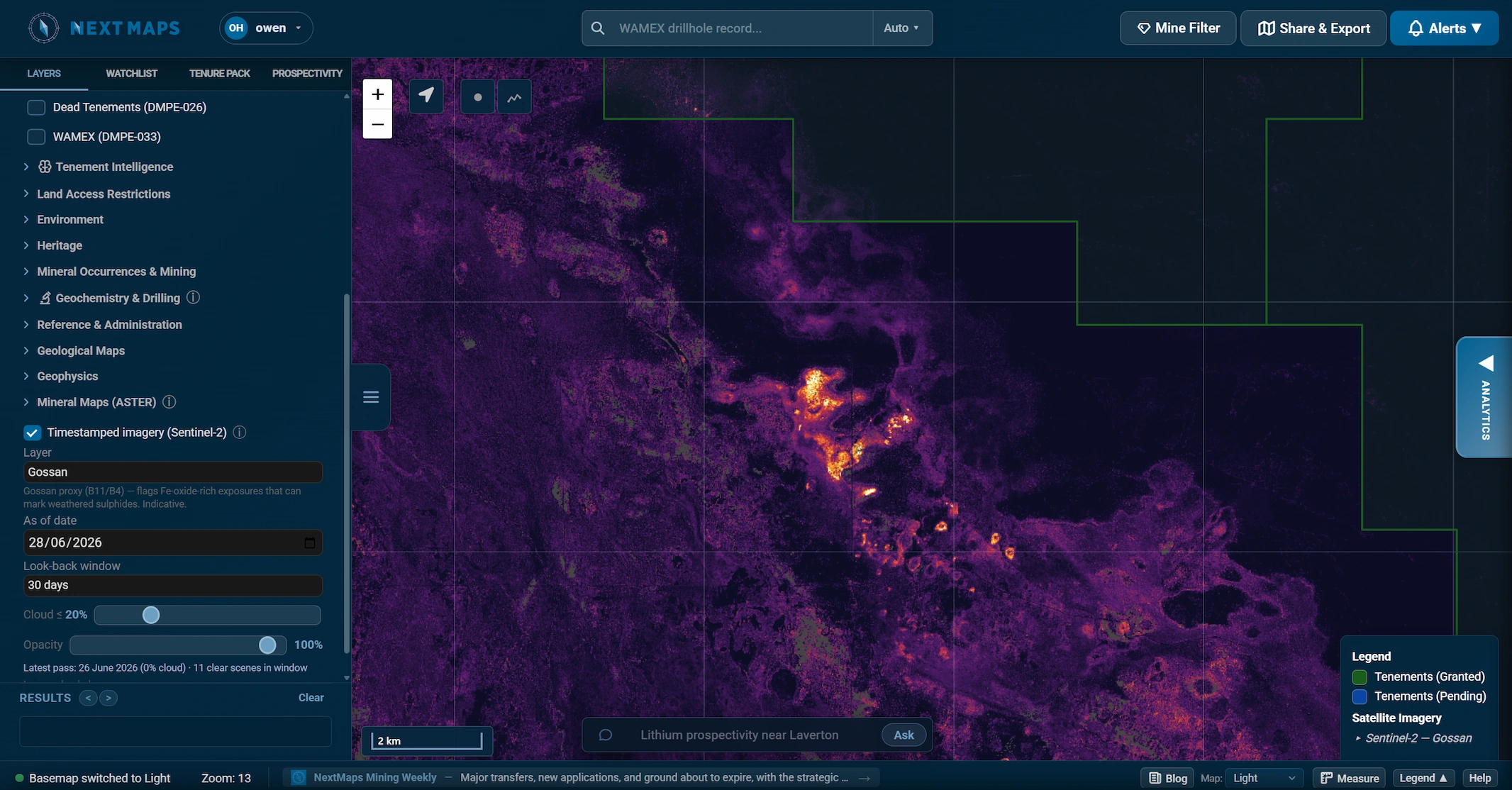
If you have not seen it yet, the last few weeks also brought ASTER and Sentinel-2 mineral mapping straight onto the tenement map, so you can look at alteration without touching a GIS package. And every WA exploration, prospecting and mining tenement now has its own page on the site, with its register detail and WAMEX history in one place.
What's next: hyperspectral. We are building EnMAP hyperspectral mineral maps and holding the release until the coverage is statewide, so it maps alteration over your ground wherever it sits rather than shipping a patchwork. Not far off.
The through-line
None of this replaces your own judgement, and it does not pretend to. A spectral ratio is a pathfinder, a harvested intercept is still someone else's number, and the authoritative record still lives with the department. What all of it does is take the half-day of downloading, filtering and cross-checking off your plate, and hand you the ground worth a closer look.
The AI Data Room is part of Pro. Open the map and point it at your ground.
Track WA tenements and find ground to peg, sell or buy
NextMaps gives exploration companies and investors instant visibility over the full WA tenement landscape.
Get started →